Destiney Bell’s yard is flooded, and this isn’t the first time. Most storms turn Bell’s lawn into a lake, transforming her house on a busy New Orleans corner into an island of inconvenience. A half hour of heavy rain means that she wades through half a foot of water just to leave her house. Her roommate, a doctor, often worries that she won’t be able to get out of their flooded driveway and to get to work. Bell works as a nanny to a 2-year old, and she hasn’t been able to take him outside to play much this summer.
Bell also worries about the kids around the school bus stop on her street. “Whatever trash or debris is in the street is getting flooded up into our yard,” she said, “I’m constantly watching to make sure they’re all OK, because with all that water, you have no idea what’s going to happen.”
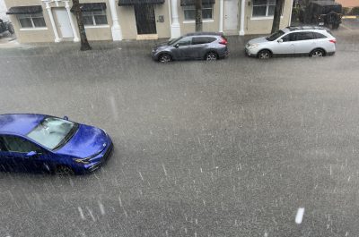
My home becomes a lake house when it rains. Located on Lake Harrison (Harrison and St. Bernard)
This story has echoes across New Orleans. Throughout this summer, major rain storms have hit the city. On July 22, one such storm dumped over 4 inches in an hour. A foot of water poured into the lobby of the movie theater on Broad Street, and a foot and half inundated Louisiana State University’s dental school.
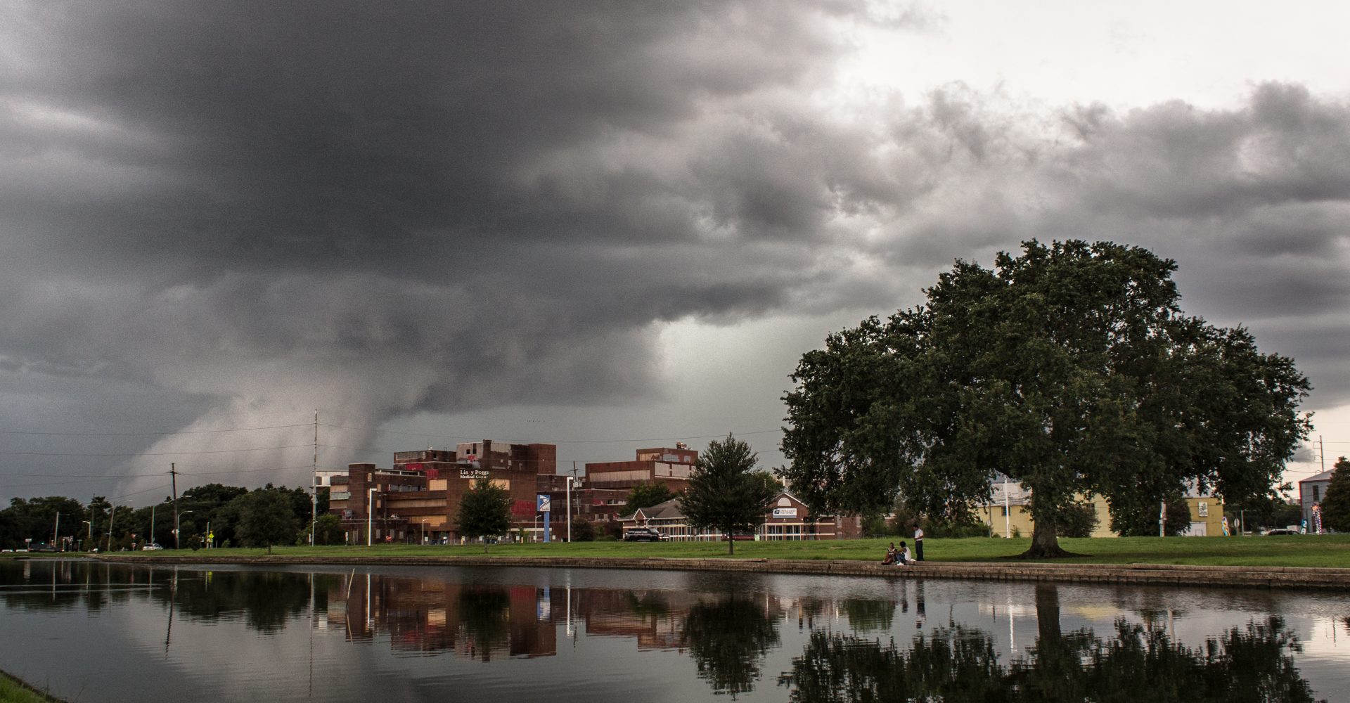
Vehicles are trapped under a bridge due to flash flooding in New Orleans Saturday July 22, 2017.
Another round of major flooding on August 5 with even greater rain totals left parts of the city in total disarray. Residents stranded in their flooded cars and homes had little warning.
A little flooding isn’t uncommon in New Orleans. It’s among the wettest cities in the contiguous U.S., with an average of 64 inches — over five feet — of rain each year.
But even for locals, this summer’s rain has felt unusual. “Weird,” as we say on ISeeChange.
According to the Southern Regional Climate Center, precipitation in May, June and July was 130 to 200 percent above normal in New Orleans. The rain totals for August 5th alone represent close to 200 percent of normal for individual neighborhoods.
The city’s pumping system was not only overwhelmed by these rain rates, it proved to be alarmingly under performing with several pumps offline, without power, or unmanned. Some neighborhoods remained flooded for approximately 12 hours before they drained. Destiney Bell’s corner remained flooded for 26 hours.
here is one more shot of the intersection of Harrison and St. Bernard at about 9:30 this morning
— carly p
Extreme cloudbursts
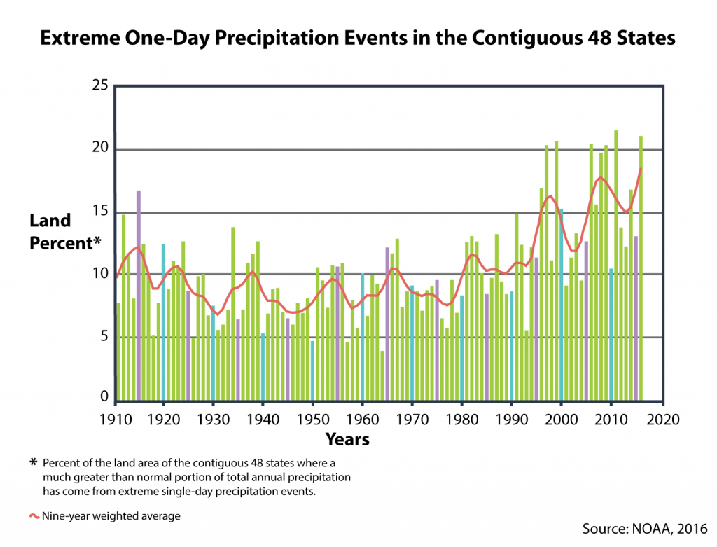
New Orleans isn’t the only place where the weather’s been weird lately. As the climate changes, heavy downpours are growing more common everywhere in the U.S. According to the EPA, precipitation from heavy rainstorms has increased 27 percent since 1958 in the Southeastern U.S.
Won Chang, an assistant professor in statistics at the University of Cincinnati, has been working to understand how to apply climate and precipitation models to real-world examples, like the ones the ISeeChange community is telling us about.
“Climate scientists know that if we have higher temperatures, then you can expect more precipitation in general,” Chang said. The increase in rainfall intensity, he added, will be even higher.
Total precipitation isn’t expected to increase by much, only about 1 – 2 percent per degree Celsius. But Chang and other scientists predict that when rain falls, it will come in more intense bursts. As a result of this, flash floods and urban flooding are expected to increase.
Local government’s role
Back in New Orleans, Bell wants to know what the city is doing to prevent floods.
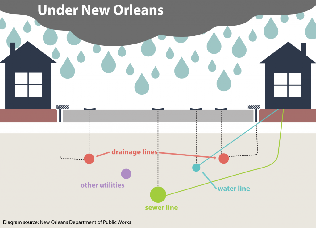
The answer involves a lot of moving pieces, because different departments in the city deal with these issues in different ways. The Department of Public Works is responsible for managing drains, catch basins and pipes under 36 inches in diameter. Sewer lines, larger pipes, and pumps fall under the jurisdiction of the Sewage and Water Board.
But for residents like Destiney Bell, surface-level drainage alone can’t solve her flood problem. Research suggests the city’s current cadre of storm drains aren’t designed for the 21st-century storms Chang and others say are the new normal.
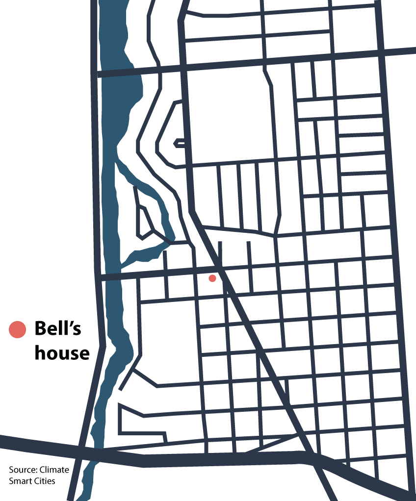
Bell’s home falls in an area called the Gentilly Resilience District, where the city is working to find creative solutions to flooding risk. Gentilly, like many newer neighborhoods in New Orleans, was built on a filled-in swamp and coastal island. This makes the area vulnerable not only to flooding, but to subsidence, which means the land is gradually caving and sinking.
Subsidence is made worse as soil is deprived of moisture by concrete and asphalt. So pumping the water out fast from this neighborhood isn’t the solution the City is aiming for.
Instead, one of the major focuses of the Resilience District is so-called “green” infrastructure. The district is planting gardens — full of native grasses, flowers and trees that absorb rainwater — which lessen the amount of water going into the overworked drainage and pumping systems. One such project is the Mirabeau Water Garden, which is designed to store 10 million gallons of stormwater and fend off subsidence.
Bell lives between Mirabeau and another project, the St. Bernard Neighborhood Campus which will integrate green infrastructure into existing sports fields and playgrounds to keep them dry.
These are the first projects of their kind in New Orleans, so it remains to be seen whether it will bring residents like Bell any relief -but that’s the hope.
Residents’ power
Even with all the projects and investment cities make to control urban flooding, residents can still feel forgotten and overwhelmed. So what can people do if they’re experiencing major flooding?
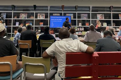
William Pestoff, water quality coordinator of the Lake Pontchartrain Basin Foundation, has worked to organize communities in New Orleans around water issues for years. He suggests that residents attend public meetings and band together as groups of neighbors to ask questions and create solutions. “Decisions are made by the people that show up,” he said.
Meanwhile, ISeeChange is working with Bell to monitor flooding on her property – syncing her ISeeChange photos with local weather data, rain gauges, soil moisture sensors, GPS, and GIS mapping. With this data, Bell will know what amount of rain it takes for her yard to flood and how long it takes to drain. It can also determine whether short bursts of rain affect her differently than longer, slower rainstorms. By monitoring her home, Bell and the city can better understand the situation and how future green infrastructure projects can be adapted to work for everyone.
Tell ISC about your flooding problems
If you’re experiencing urban flooding in New Orleans or another city, you can start posting to our flooding investigation right now. Use your posts as a log to better understand how much rain, in how much time, it takes your area to flood. We want to know if you’re noticing more intense storms and what that means for your neighborhood.
Story by Samantha Harrington for ISeeChange in Partnership with Yale Climate Connections
Cover Photos by Liam Kennedy/ ISeeChange and Kevin O’Mara/Flickr
Note this story has been updated from its original version which was published at 10 am on August 5th. The ISeeChange team will be reporting more with the data we have from this and other flood events. Stay tuned…